
This exhilarating scenic coastal walk across Brean Down enjoys all that is best about a Somerset holiday cottage break!
The Lowdown
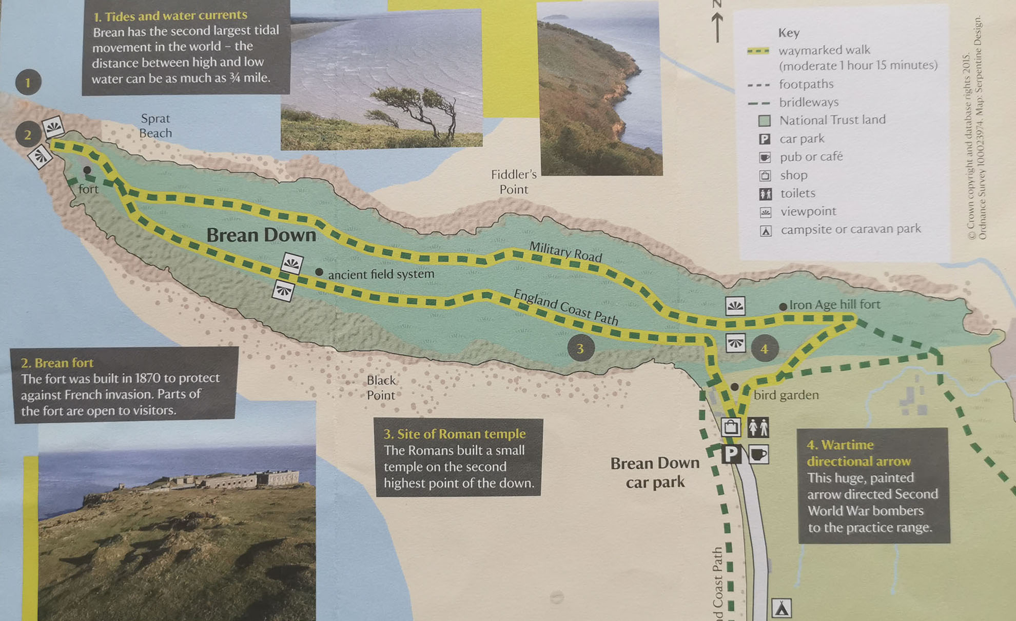
Map of the walk
In brief: Brean Down is a natural pier with dramatic cliffs and a Victorian fort.
Terrain: This is a moderate walk. It is steep at first, with a flight of steps. Paths are grassy and rocky in places and it is not suitable for the infirm or the disabled. Good footwear is advised.
Start point/amenities: Cove Café – grid ref: ST 296588. There are toilets, a Visitor Centre and a Café.
Time: 50 mins - 1 hour 10 mins.
Distance: 3 miles circular route (4.8km).
Maps: Landranger Map 182; OS Explorer Map 153.
Height gain: 97 metres over the walk.
Other info: If on Brean beach (not NT) be aware of deep mud at low tide.
Keep an eye out for changes in the weather as there is little shelter on top of the Down.
The walk is great for dog walking but please keep dogs on leads and supervise children closely as there are steep cliff edges and free roaming cattle and goats.
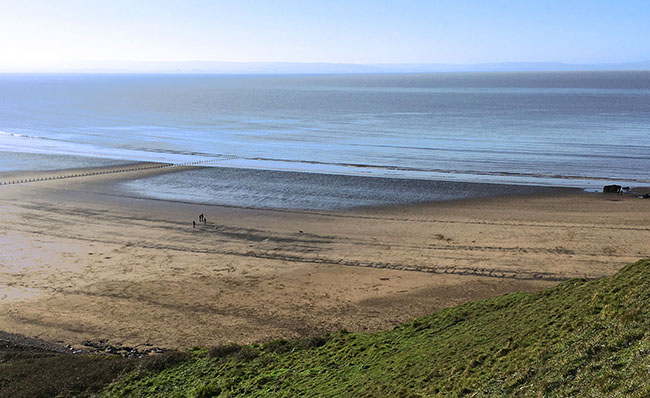
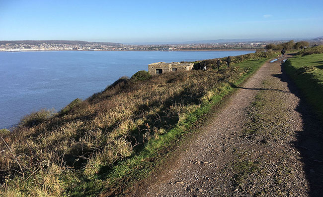
View of Brean beach from the top of Brean Down
Highlights
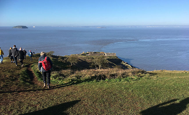
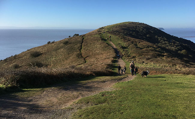
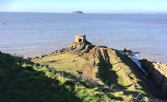
Approaching Brean Down Fort at the tip
The Down rises up nearly 100 metres and offers spectacular views of the Somerset coastline, Weston-Super-Mare, Brean and the south coast of Wales looking across to Penarth and Cardiff on a clear day, as well as Steepholm, Flatholm and the Somerset Levels. Jutting out 2.4km (1.5 miles) into the Bristol Channel, its tidal range is the second largest in the world.
The Down is steeped in intriguing stories, from prehistoric worship to Second World War weapon testing.
There are examples of Brean’s military past all over the Down and you will find the remains of Brean Down Fort at the tip.
A great geology walk, fossilised creatures such as arctic foxes and reindeer have been found on this limestone headland, while rare wild flowers flourish in its thin soil.
Brean Down is also renowned for its wildlife, so keep a look out for a great variety of birds, and butterflies whilst on route.
The Walk
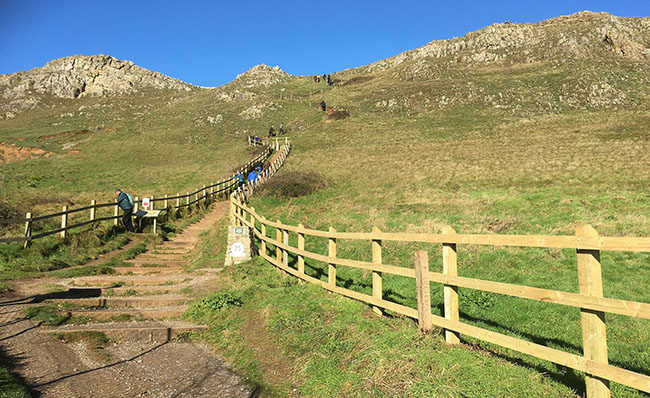
The flight of steps at the start of the Brean Down Walk
Follow this link for a detailed description and map of the walk.
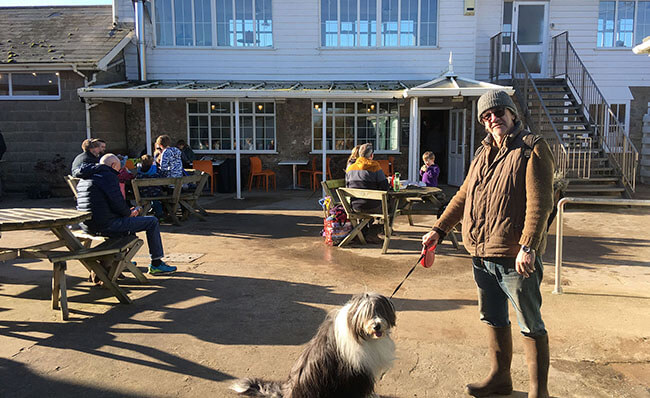
Cove Café
Starting at Cove Café, follow the road towards the headland until you reach some fairly steep steps. These will lead you up on to the Down.
On Brean Down
Once on the Down, take the path to the left, along the southern slopes. Wildlife thrives here due to the rocky limestone grassland and warm south facing cliffs. In early summer look out for the white flowers of the rare white rock rose, which grows in abundance in the thin limestone soils. Listen out for the loud, sharp call of the stonechat. You may also be lucky enough to catch a glimpse of skylark, meadow pipit, linnet, raven and peregrine falcon.
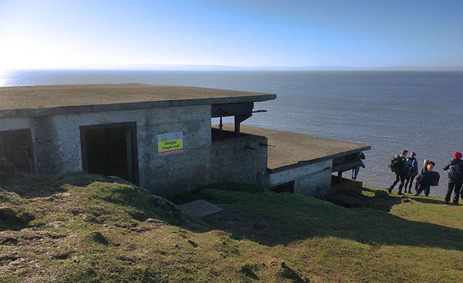
A WWII lookout post further up the hill
Continue along the path until you come to the site of a Romano-Celtic temple. It was built in about AD 340, close to a Bronze Age burial mound. Rock from a quarry on the Down provided some of the stone for the building. Discover too a World War 2 lookout post further up the hill.
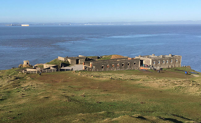
Brean Down Fort
Continue towards the fort, where you can take a closer look at the remains of the fortifications and enjoy spectacular views across the Bristol Channel.
Searchlight bunker and rail track for 'bouncing bomb' at the tip of the Down
Brean Down was also used as a base for the intriguingly named Department of Miscellaneous Experimental Weapons. Amongst the weapons tested, one of the more well known was a ship launched 'bouncing bomb'.
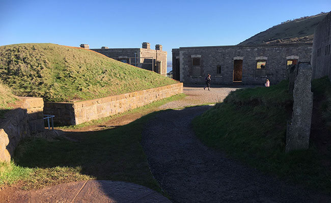
The Fort
The Fort was built in the 1860s - part of a grand scheme of defences devised to see off the threat of a French invasion. Such fortifications have since become known as Palmerston's Follies on account of the fact that they became obsolete within just a few years of being built as a result of large scale improvements in naval gunnery. Brean Down Fort was home to three 7 inch rifled muzzle loading guns. Working with similiar batteries on the Welsh coast and on the islands of Steep & Flat Holm the fort served to protect the city of Bristol from raiders navigating up the Severn Estuary. The fort was destroyed in 1900 by a rogue artilleryman who discharged his weapon down the ventilation shaft leading to No. 3 magazine. The site was rendered unusable and remained out of use until World War 2.
Brean Fort Gatehouse on the north side of the Down
To complete the walk take the military road back on the north side of the Down. This will take you past numerous hard standings which mark the locations of various World War 2 buildings (now gone) and half way down the road, the Victorian era Brean Fort Gatehouse.
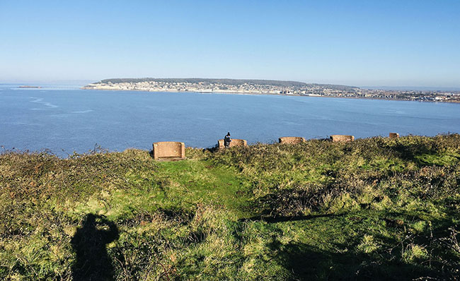
Battery overlooking the bay on the north side of the Down
Further on still there are six brick built Lewis Gun positions overlooking the bay and the huge crest of mud and sand that is Weston Super Mare beach. The fort was re-armed at the start of World War 2 when regular drill and gunnery practice was part of the routine for the Coastal Battery Regiment. After this, follow the path round to the right and take either a sloped walk or continue back to the steps you came up.
Make a break of it
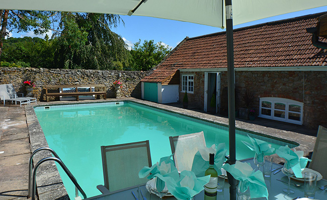
Hillside Barn, near Cheddar, with private pool and sauna, sleeps 5
For the opportunity to enjoy the Brean Down Walk, why not book one of our Somerset holiday cottages, all within an hour’s drive? Explore the county’s beauty and enjoy this and other amazing walks on a break that is filled with plenty of adventure and fresh country air!
Published on Sunday 15th March 2020 by Linnie Clements
Follow us on social media